History, Art & Culture
The North Down Coastal Path is the jewel in the crown of the Borough and has been since Victorian times. As such, it has provided inspiration for artists and photographers alike and is steeped in history and folklore. Below, we look at:
- The Columban Way
- Local Artists and Photographers
- Shipwrecks off the North Down Coast
- History of Crawfordsburn
- Legend of Jenny Watt
- The Old Coach Road at Orlock
- The History of the Long Hole
Columban Way
The history of Bangor, Co Down is inextricably linked with the great Saint Columbanus. Born in 543, he is said to be one of the greatest missionaries of the early Catholic Church, leading the “Hiberno-Scottish mission” of conversion across much of what is now Western Europe in the late 6th and early 7th century CE.
Although St Colombanus was not a native of Bangor (being born in Leinster, Ireland) he later studied at the monastery of Bangor until 590. It was here he was educated, studying Greek and Latin under the tutelage of St Comball, who was the Abbot of Bangor Monastery. Columbanus was said to be a handsome man, but with a serious temperament with a keen interest and desire for learning.
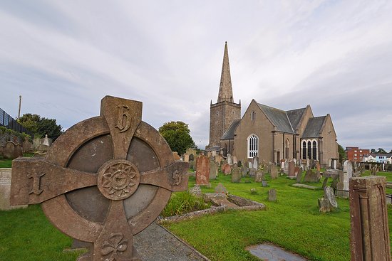
Around 590 CE, St Columbanus began his travels through Europe with twelve companions, including St Gall. He was welcomed throughout his travels and founded several monasteries throughout Italy, France, Belgium, Germany and Switzerland
St Columbanus died in 615 CE. In recent years, Pope Benedict XVI expressed his opinion that St Columbanus be called a “European Saint” due to his work across Western Europe.
St Columbanus is also remembered cas expressing his Irish identity through his writing. In a letter St Columbanus wrote to Pope Boniface IV, he employed the words “we Irish”.
As a legacy to the works and travels of Saint Columbanus, the Columban Way is a Europe-wide cultural project, developing a route that crosses from north to south, linking up a network of historic sites across the island of Ireland, England, France, Germany, Switzerland, Austria, Liechtenstein and Italy. After the Camino de Santiago, the Columban Way will be the longest heritage trail in Europe, crossing the most regions and nations.

The route mostly crosses rural and mountain areas, including small towns and villages. The importance of this route has the added benefit of bringing tourism to many areas, some lesser-known, and of involving local communities. As such, the inclusion of a large part of the North Down Coastal Path in the route is a great honour and boost to our area.
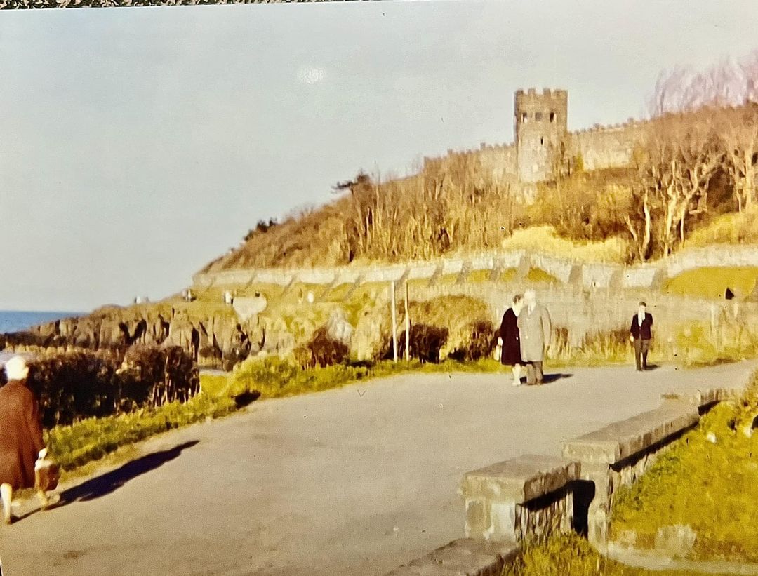
On the website thecolumbanway.org the coastal path is mentioned in this way “In Northern Ireland ….. the last section of Columban Way in Ireland will run past Strangford Lough up to Bangor, the pilgrim entering the town along a rocky coastal path that would have changed little since the time of the Saint.”
Many people base their holidays on the Columban Way, given its significance spiritually to so many people. It makes it even more important to ensure that the calm, reflective character of so much of this coastal path is preserved.
The Legend of Jenny Watt
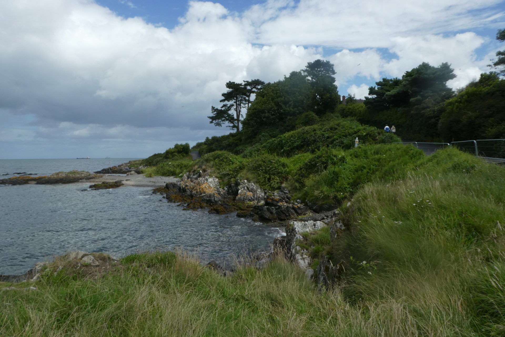
There are several legends and rumours surrounding the mysterious ‘Jenny Watt’ who purportedly was the daughter of a nearby tavern called the Jolly Fisherman. She is said to have been an excellent sailor, and became involved in local smuggling. The name ‘Jennifer’, appropriately, means ‘White Wave’ in Celtic. Legend has it that Jenny Watt’s Isle, off Ballymacormick Point provided her with a route to dodge capture, and that Jenny Watt’s Cave, near Smelt Mill Bay provided a route for smuggling which extended landwards by several miles. It is said that she took shelter in this cave while hiding from the excise men, after which she disappeared. Rumour has it that she perished there, but can be seen on Brompton Harbour at the last Friday in November.
A diver attempted to enter the cave in the 1950’s but was unable to go far due to the amount of silt. The cave is said to have been blocked when nearby rock was blown up to create Marine Gardens.
Whether the legend of Jenny Watt’s has any foundation is open to debate, however it is well documented that smuggling was rife along the North Down Coast so stories such as this would always have some feasibility.
History of the Long Hole
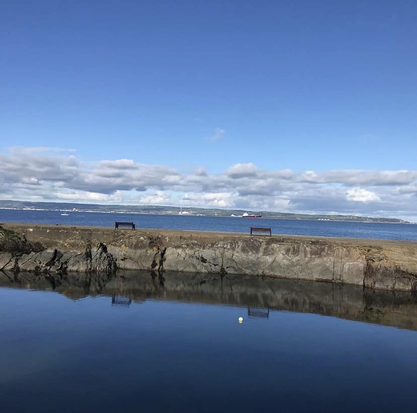
The Long Hole has been devoid of boats since Bangor Marina was completed in the 1980s. But how did it come about in the first place? There seems to be two prevailing accounts – the first that it was blasted out in order to provide stone to create a wall around the nearby Castle estate and the second that it was intended as an ‘breakwater’ across Bangor Bay. From old Ordnance Survey maps and literature, the Long Hole has remained relatively unchanged for nearly 200 years. One thing however is for sure, this quirky little corner of Bangor has become much beloved of locals to sit and reflect on the benches there, with an uninterrupted view towards the Lough. This man made structure has also become an unintentional haven for wildlife, much beloved of the local black guillemots, herons, seals and even kingfishers and bats which feed on the rich pickings on offer.
Coach Road Orlock
Steeped in history, this old Road is situated on what is now National Trust land between Portavoe and Sandeel Bay. The remains of a clear pathway are in evidence along this area, including an old tunnel and areas of rock which have been hewn to provide width.
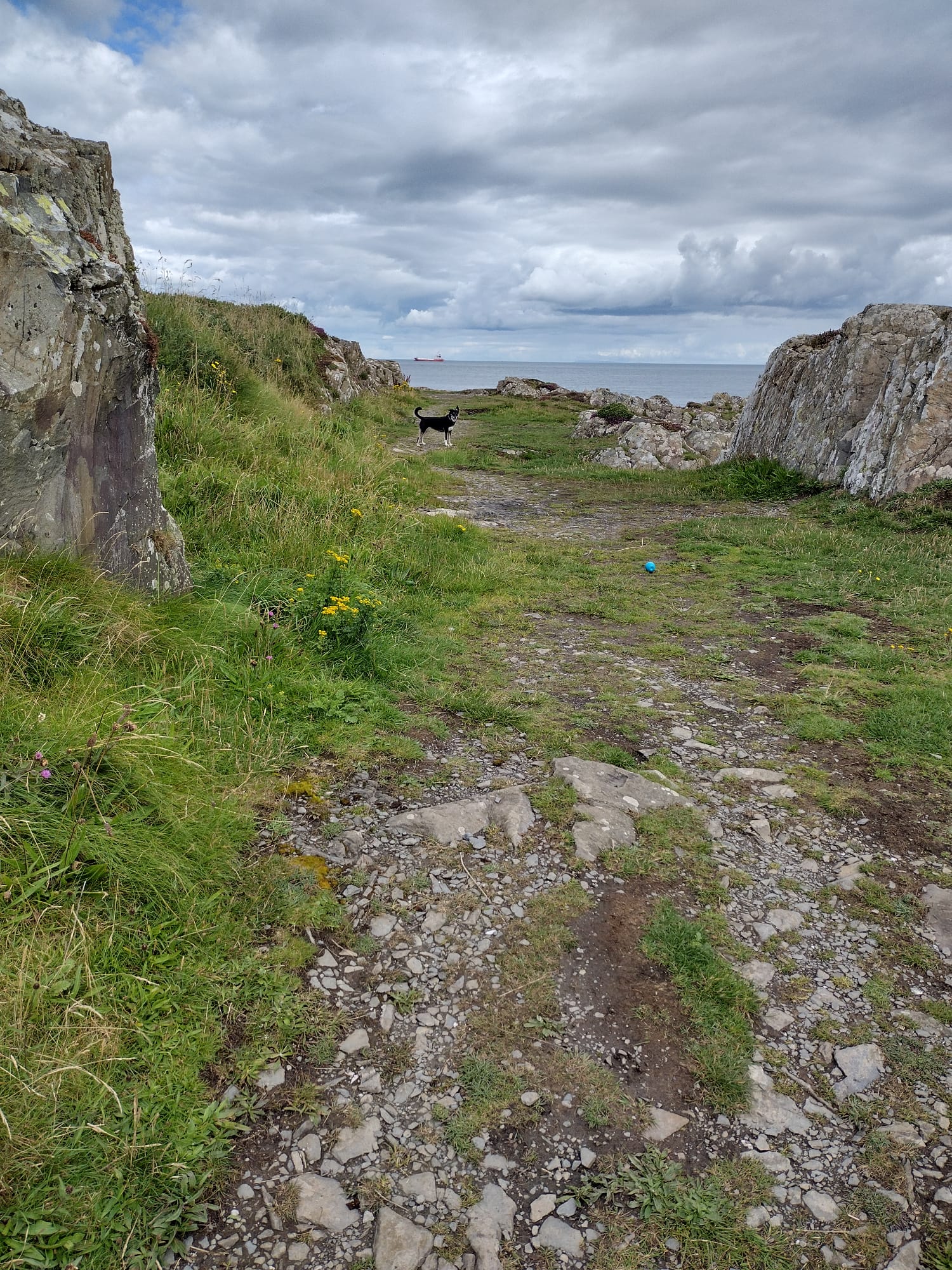
As is so often the case, the historical facts in relation to the Old Coach Road can be hard to disentangle from legend, folklore and hearsay. Various narratives have prevailed through the years. Those that have any credibility include that it may have been a vanity project, built by the local landowner, David Ker. This would have been typical in Victorian Times in which walls and structures from natural stone were a sign of status. It is also said that it could have been built as an ‘Adrenelin Ride’, being so close to the coastline and traversing rocky terrain across bridges and coves. It may have been a Smugglers Track, with Smuggling being a real problem in the 1700s and 1800s. In 1825 the Coastguard spent a lot of money creating and manning various stations in the area, but Mr Ker resisted and delayed the one positioned at Orlock, and the station in the Copeland Islands was never completed. It may have been a Quarry Road, as the Ker family already had done so elsewhere, and it is said that they wished to quarry stone at Orlock and transport it, that the road was constructed but that the work did not proceed.
In any event, the work to construct this road would have been arduous due to the nature of the rock and the proximity to the coastline. Rock faces had to be cut away and rock and shingle used to enable the road to traverse inlets and coves. It is possible that bridges were also used in some areas, but there is no longer any physical evidence left to support this.
Whatever the origins, the Old Coach Road has now been left to the elements, and now the overgrown remains blend with the natural landscape to create an interesting and attractive walk and unique protected habitat.
Art, Poetry and Photography inspired by the path
There are many local artists, photographers and poets who take inspiration from the North Down Coastal Path and the areas along it. Here are just a few.
Martyn Boyd (Photographer) In 2023 had an exhibition of his work on display at the Heritage Centre, including several of the coastal path. “The North Down coastal path is a little piece of ruggedness with a spirit of wildness right on our doorsteps. It’s a fabulous place to go to when I feel I need that to wash over me and inspire me. “
Deirdre Oram (Artist) lives near the path, and her love of the water, the changing climate and landscape fills her work. Her website references the importance of the location of her studio beside the water: “From it she is constantly aware of the ever-changing moods of sky, sea and land. This is the reason why water features in so much of her work….”
Liane Radcliffe (Photographer) Liane’s wonderful work features splendid scenery from all over Northern Ireland, but in particular the North Down area where she lives and loves so much. Some of her photographs of the Long Hole in stormy weather are quite simply stunning.
Marianne McShane ( Author and Storyteller) Marianne is the author of ‘Rónán and the Mermaid’ and ‘The Fog-catcher’s Daughter’ – children’s books which are steeped in the folklore and beauty of Ireland. Marianne has beguiled audiences in many different countries with her enchanting storytelling, so much inspired by her love of the coastline in the town in which she lives.
Tim Dwyer (Poet) – Tim’s poems appear in publications world-wide. He is originally from Brooklyn, New York – but now lives and finds inspiration here in North Down which features in so much of his work, including “Sunday Bangor”.
Gary Gray (Photographer) has a particular love of Crawfordsburn, and has dedicated a Facebook Group to the wonderful photographs which capture this special area. Gary says: “The North Down Coast is my ‘home turf’ – I love that the scenery is always changing which means that I never know what I might see at different times of the day, or as the seasons change. There is no place like it. The variety of wildlife is amazing, and there is often a surprise waiting round every corner”
There are many more people, both professional and amateur who take inspiration from this special place.
Shipwrecks on the North Down Coast
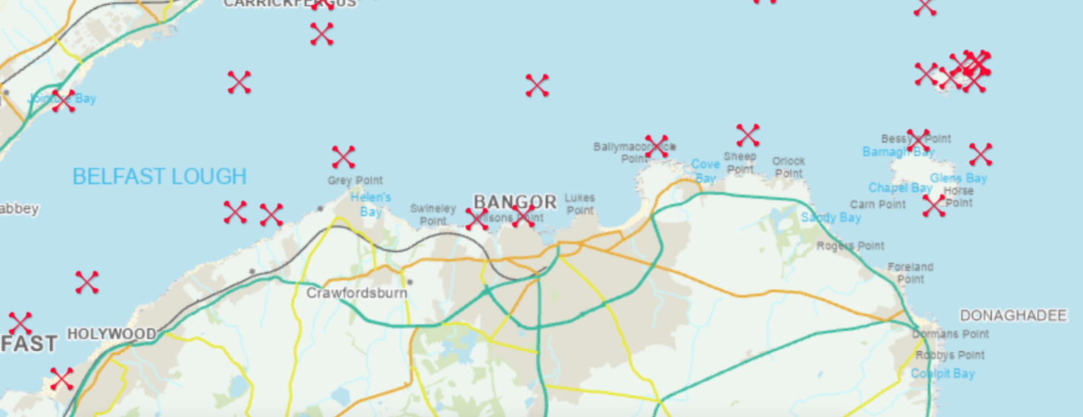
As with so many islands, the coastline of North Down is littered with shipwrecks, here are brief details of a few, while so many more can be found on websites such as Irish Wrecks Online or by buying Ian Wilson’s book Shipwrecks of the Ulster Coast. Some of the better known wrecks here include:
- The SS Troutpool, located about 2km North of Bangor. This ship – owned by Poole Shipping Company, of Hartlepool, carrying grain from Argentina to Glasgow entered Bangor Bay to undertake degaussing – a procedure to prevent activating electronic mines. Other ships in the area dropped lifeboats to assist, but sadly 11 crew members’ lives were lost.
- The S.V Inverurie, which struck rocks at Ship Rock at Ballyferris on 15 November 1914. Inveruruie was carrying salt bound from Belfast to Newcastle, then Sydney, Australia. The crew were rescued by Donaghadee Lifeboat.
- The M.V Fredanja, located to the east of the Copeland Islands. This ship ran aground on 1 January 1942 and was bound from Maryport to Donaghadee carrying coal. She had been one of the evacuation fleet in Dunkirk in May 1940.
- The S.S Annagher, located just off Ballymacormick Point. The ship was wrecked on 11 December 1937 en route from Belfast to Llanelly, Wales carrying scrap metal. The crew (of ten) tried to beach the vessel after she developed a list, but did not succeed and sadly all the crew bar one (a William Hunter, who was saved by the Groomsport lifeboat team) perished
- The Bangor. Located about 2km from Ballyquintin Point. The boat sank on 1 March 1934 en route from Portland to Belfast with a cargo of Portland stone which was to be used in the construction of Stormont.
However, shipwrecks in the area are documented by the NIEA Historic Division and can be found by accessing their website here. Using this website, it is fascinating to see how many shipwrecks lay beneath our waters. Many more resources can be found on this website, including advice for divers, codes of conduct and more information.
History of the Path at Crawfordsburn
Although there were walks along the promenade at Bangor towards Brompton from Victorian times and before, the path was not accessible by the public further along the coastline, and the beaches at Crawfordsburn and Helens Bay were hemmed in by private residences and by sand dunes. From the 1960s there were negotiations to open this up to the public.
This excellent article discusses the history of the path and the development of Crawfordsburn, Grey Point and Helen’s Bay, prior to the opening of Crawfordsburn Country Park in 1971. It gives details about how it was built and how at one point the authorities wished to charge people for access to Helen’s Bay Beach.
The old house at Crawfordsburn has had a mixture of uses through the years. It was designed by Vincent Craig and built in 1906, to replace what was considered to be an “excessively ugly” building, which was then demolished. It was first occupied by the Rt Hon Robert Gordon Sharman-Crawford. In 1935, after Crawford’s death, the house was passed to W J Stewart. In 1948 the house was sold to the Northern Ireland Tuberculosis Authority. In 1959, the Northern Ireland Hospitals Authority took the building over, which was then used as a geriatric hospital. In the 1980s this was sold to private ownership and in 2000 was developed into apartments.
Of interest, a plant called the “Crawfordsburn Fern” (Polystichum setiferum ‘Crawfordiae’ was discovered here, previously believed to be extinct.